BC Adventures
Seabird Island: Sq'éwqel, Sumás Mountain Views, and a Slow Drive Through Stó:lō Country
Twenty minutes east of Chilliwack, the road bends onto Seabird Island — Stó:lō homeland, working farmland, and one of the best mountain backdrops in the Fraser Valley. Here's what we've learned about the place and why we keep going back.
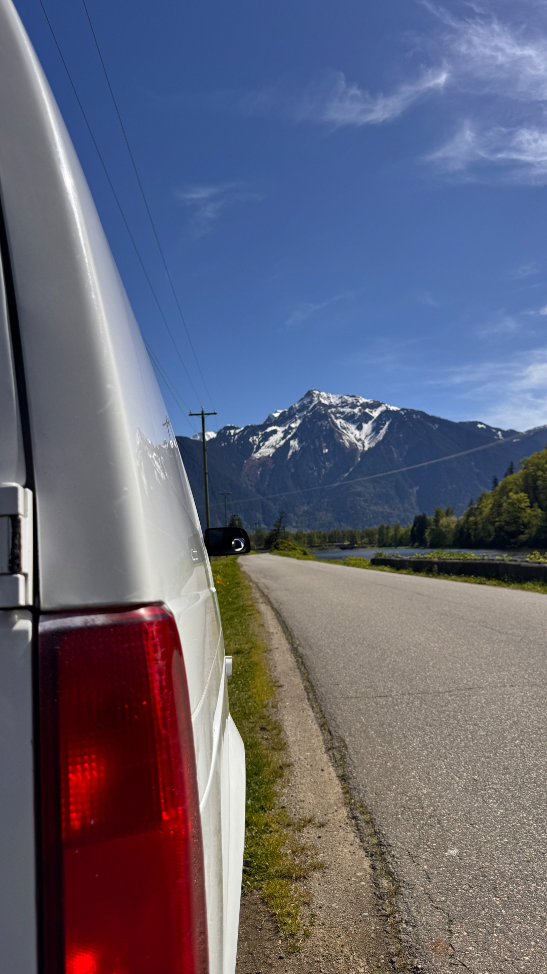
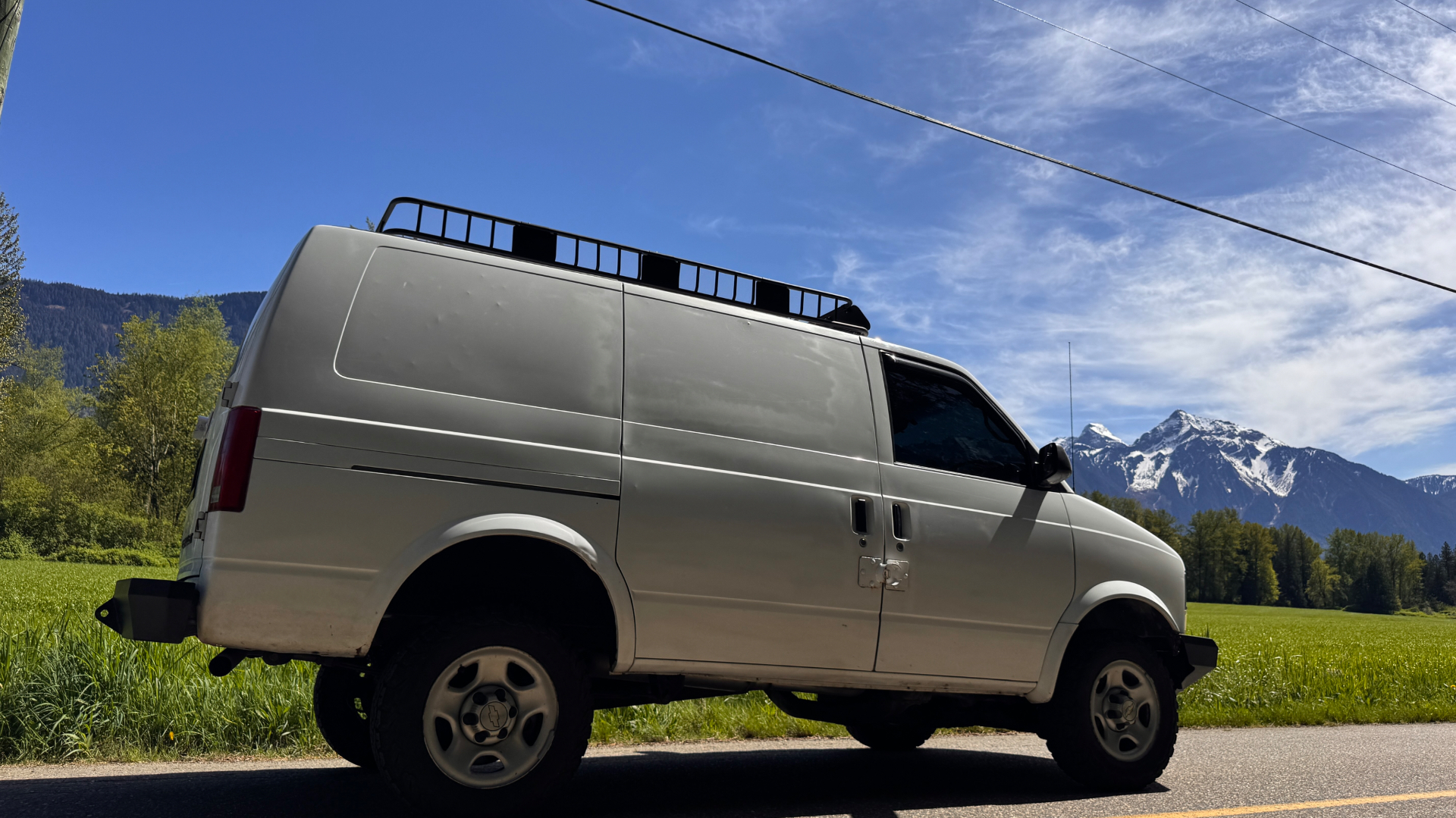
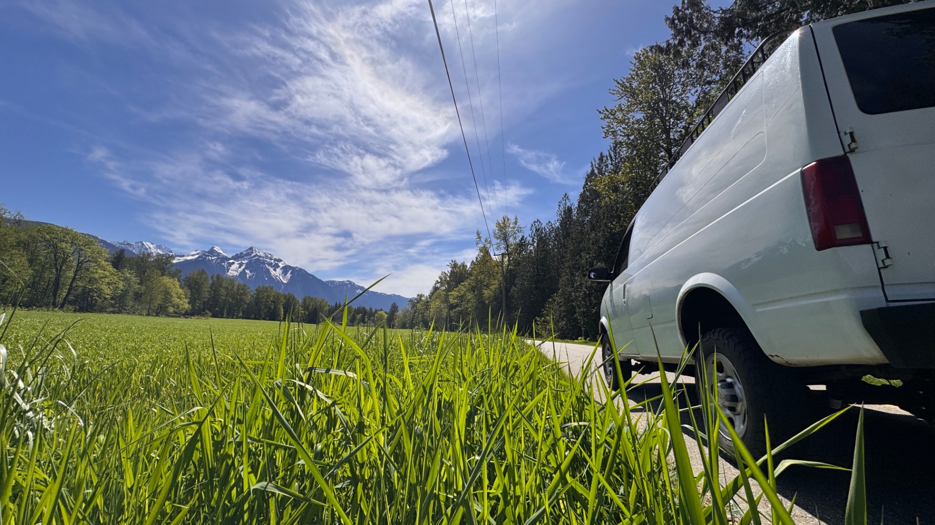
Some drives you take because you're going somewhere. Seabird Island isn't one of them. We go there to slow down — to put the Astro on the quiet farm roads east of Agassiz, roll the windows down, and look up at the mountains that hem the Fraser River in on both sides. It's twenty minutes from our driveway in Chilliwack and it never gets old.
This post is part trail-side photo essay, part history lesson. Because Seabird Island isn't just a pretty corner of the Fraser Valley — it's Sq'éwqel, the ancestral and modern home of the Seabird Island Band, one of the Stó:lō Nation communities that have lived along this stretch of the river for thousands of years.
Where It Is
Seabird Island sits on the north side of the Fraser River, between Agassiz and Hope. From Chilliwack you cross the Rosedale–Agassiz bridge, hang east on Highway 7, and a few minutes later you're on the island — though "island" is a soft word for it now. The Fraser used to wrap around the north side; today the back channel is mostly slough and farmland, but the name stuck.
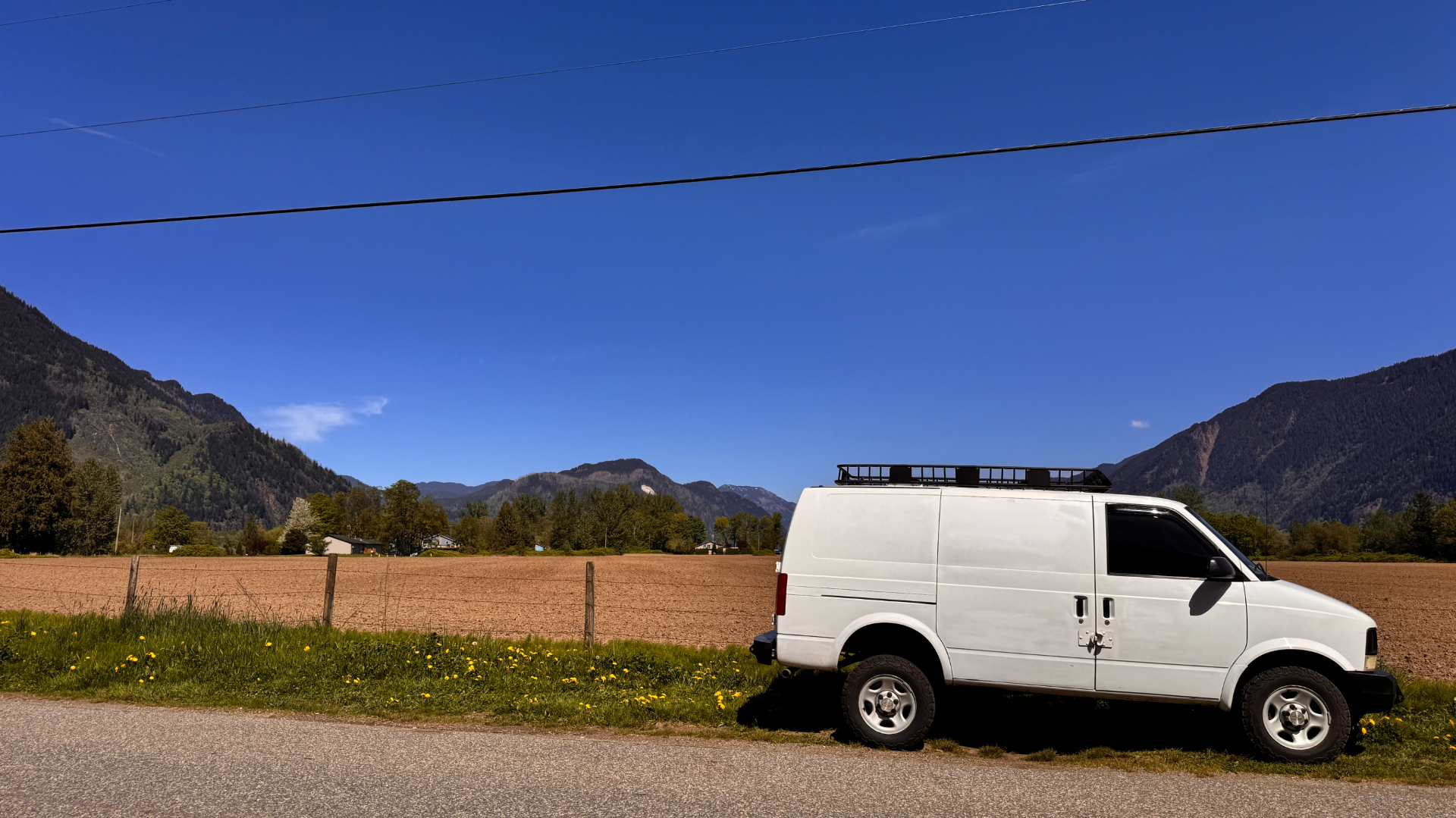
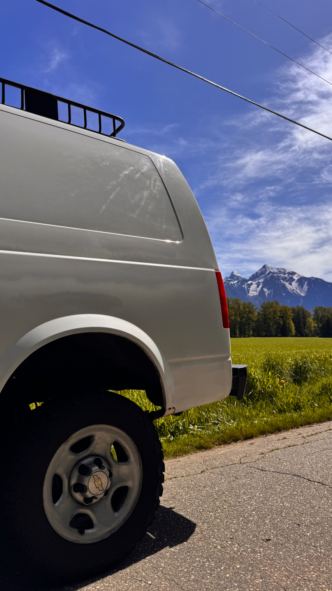
The island is roughly 2,500 hectares of flat alluvial bottomland — some of the richest soil in the province — wedged between the river and the foot of the Cheam Range. Drive any of the roads that grid it and you're looking at corn, potatoes, blueberries, hayfields, and pasture, with snow on the peaks pretty much year-round.
The Name: Sq'éwqel
In Halq'eméylem — the upriver dialect of the Stó:lō language — the community's name is Sq'éwqel, often translated as *"turning point"* or *"a place where the river bends."* That's exactly what it is. The Fraser swings hard around the bottom of the Cheam Range here, and Stó:lō families have fished, gathered, and lived at this bend for generations beyond easy counting.
The English name "Seabird" comes from a much shorter story: the SS *Seabird*, a sternwheeler that ran aground and was abandoned on the island's south shore in 1858, during the Fraser Canyon Gold Rush. The boat is long gone. The name on the map stuck.
The Stó:lō and the Seabird Island Band
The Stó:lō — literally *"river people"* in Halq'eméylem — are the Coast Salish peoples whose territory follows the Fraser from roughly Yale down to the river's mouth at the Salish Sea. There are around two dozen Stó:lō First Nations communities along that stretch. The Seabird Island Band (Sq'éwqel First Nation) is one of the larger ones, with a membership of roughly 950 and the bulk of the island as its reserve.
A short, honest sketch of the history — the parts a sign at the side of the road doesn't tell you:
- For thousands of years, the Stó:lō moved seasonally along the river — fishing salmon at known eddies, hunting elk in the mountain meadows, harvesting cedar, berries, and roots.
- Smallpox swept the river in 1782, before the first European reached the lower Fraser, and killed an estimated two-thirds of the Stó:lō population. The communities that survived consolidated into fewer permanent villages.
- The colonial reserve system in the 1860s and '70s carved tiny parcels out of vast traditional territory. Seabird Island itself was set aside as a shared reserve in 1879 for several upriver Stó:lō communities, and didn't become its own distinct band until 1959.
- Today the Seabird Island Band runs its own schools (including a well-regarded community school and the Seabird Island Community School), a health centre, an early childhood program, and economic ventures including farmland leases and the annual Seabird Island Festival each spring — one of the longest-running Indigenous cultural festivals in the province.
When you drive across the island, you're a guest. The roads are public and the views are free, but the place is somebody's home, somebody's grandmother's fishing spot, somebody's grandfather's field. Drive slow. Wave at the farm trucks. Don't fly drones over the village. Don't pull into driveways to take photos.

What the Drive Actually Looks Like
There's no marked "scenic loop" here. You just point the van down any of the cross-island roads — Seabird Island Road, Chowat Road, the back lanes that connect them — and let the views do the work.
A few things we've figured out over a half-dozen trips:
- Go in the morning. The Cheam Range faces west, so the snow on Mt. Cheam, Lady Peak, and the Lucky Four lights up early. By mid-afternoon the peaks fall into shadow.
- Spring and early summer are the best. The grass is electric green, the fields haven't been cut yet, and there's still real snow up top. By August everything browns out and the haze rolls in.
- The river road on the south side (toward where the *Seabird* ran aground) gives you the cleanest river-and-mountain compositions. It's also where you'll find the spot we shot the cover image — a pullout above a slough with Mt. Cheam filling the whole windshield.
- Stop at the farm stands in season. The blueberries and corn here are legitimately some of the best in the Valley.
The Mountains You're Looking At
Most of the dramatic peaks you see from Seabird Island are part of the Cheam Range, a steep ridge of the Skagit Range of the North Cascades. From south to north along the skyline:
- Mt. Cheam (2,107 m / 6,913 ft) — the big triangular one. The Halq'eméylem name is Theá:tel. In Stó:lō tradition she's the mother of the Cheam range, watching over the river and her three daughters (the other peaks).
- Lady Peak (2,179 m) — the sharper summit just north of Cheam.
- The Lucky Four Group — Stewart, Foley, Welch, and Baby Munday — the cluster of rocky peaks farther up the range.
From the river road you also catch the south wall of the Valley — Sumás Mountain, Vedder Mountain, and on a clear day the bulk of Mt. Slesse in the distance.
Why It Matters to Us
We talk a lot on this site about going deep into the BC backcountry — the FSRs, the alpine, the multi-day trips. The truth is, most of our driving happens within an hour of home. Seabird Island is one of those places that reminds us we don't need to chase epic to find beautiful.
It's also a humbling drive. The Astro is a 21-year-old van; the Cheam Range is older than measurement; the Stó:lō have been here longer than every empire that's ever claimed to own this valley. Pulling over on a quiet road, killing the engine, and just listening for a minute puts the build in perspective.
If You Go
- Respect the community. Stay on public roads. Don't enter the village or fly drones. The reserve is a working community, not a tourist site.
- Watch for farm equipment. The roads are narrow and tractors have the right of way, always.
- Support local. The Seabird Island Band runs a gas station and convenience store right off Highway 7 — fill up there if you're passing through.
- Learn more. The Stó:lō Nation's Stó:lō Research and Resource Management Centre and the Seabird Island Band website are the best primary sources for the history above. Anything I've gotten wrong here is mine to fix — corrections welcome by email.
---
Related from the build log:
- Fraser Valley's Hidden FSRs: Our Local Favourites — more close-to-home BC driving.
- Overlanding in a 2WD: A BC Backcountry Guide — how the Astro handles BC, paved and unpaved.
- Harrison Lake FSR: Two Days of Quiet Water and Smoky Sunsets — half an hour north of Seabird, a very different kind of trip.
Want to follow along as we explore more of the Fraser Valley? Read about the build or get in touch and tell us your favourite quiet drive.
Share this post
Comments
Loading comments…